16 November 2026
Field notes: the gargoyle that lost its nose and nobody noticed for two years
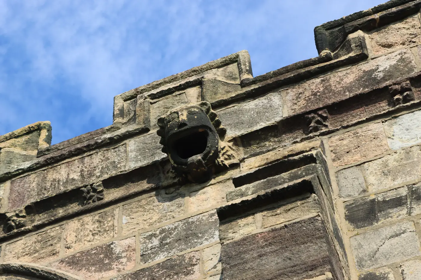
Every conservation officer has a version of this story. Someone's doing the walk-round ahead of a quinquennial, binoculars up, and they stop on a gargoyle that's been grinning off the north parapet for six hundred years. Except it isn't grinning anymore. The nose is gone. Clean sheared, probably frost action on an old repair joint, and from the ground it looks like it happened last week.
It didn't happen last week. The last full photographic record has the nose present, slightly chipped but present, and that record is two inspection cycles old. Somewhere between then and now, on a corbel nobody climbs to unless there's scaffold up for something else, a piece of carved limestone the size of a fist came off and nobody logged it.
This isn't a story about a careless surveyor. It's a story about how condition records get compared in practice, which is: an officer pulls up last time's photo on a laptop, squints at this time's photo on a phone, and tries to hold two different lighting conditions, two different lens angles, and two different seasons in their head long enough to say "that looks the same" or "that looks worse." Elevation photography from a cherry picker on an overcast Tuesday in March does not sit next to elevation photography from another cherry picker position on a bright Thursday in September and offer itself up for easy comparison. The officer ends up comparing two photographs of the stone, shot under different light, by different people, years apart, and trusting their eye to do the subtraction.
Most of the time the eye does fine. Spalling at the base of a buttress, a crack that's visibly widened, staining from a failed rainwater goods joint: these tend to announce themselves. What they're bad at catching is loss at height, on a surface you don't walk right up to, where the before-and-after difference is a shadow that isn't quite where it used to be. A nose is a small, high, three-dimensional thing, and in a flat photograph its absence looks like a slightly different angle rather than a gap.
What would have caught it is something that doesn't rely on the eye doing that subtraction at all. A proper 3D model, built once as a baseline and flown again at the next review, gives you a surface to measure against rather than a photo to recall from memory. Instead of asking whether this looks different from last time, you ask the model to show you where the geometry has changed, gargoyle, corbel, pinnacle, parapet coping, all of it, at a resolution fine enough to catch a lost nose rather than just a lost pinnacle. That's the gap between a photo album and a baseline: one is a record of what the building looked like, the other is something you can overlay onto the next survey and get a real answer from.
None of this makes the inspection cycle less useful. Hands-on, close-up checks by someone who knows stone will always catch things a drone pass won't, mortar that sounds hollow when tapped, a joint that's gone soft. But for the slow, easy-to-miss losses at the levels nobody climbs between scaffold jobs, a measurable record beats a remembered one. We built our drone and aircraft survey service around exactly that gap, turning a condition visit into a baseline you compare against rather than a set of photos you compare by eye.
If your last full survey predates your current gargoyles having all their features, it might be worth finding out before the next quinquennial does.